Grand Staircase-Escalante National Monument, Utah $2,100 • September 30-October 5, 2024
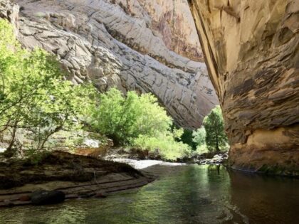
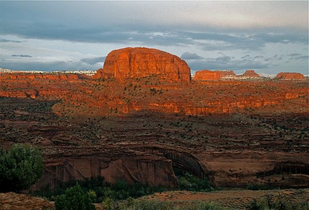
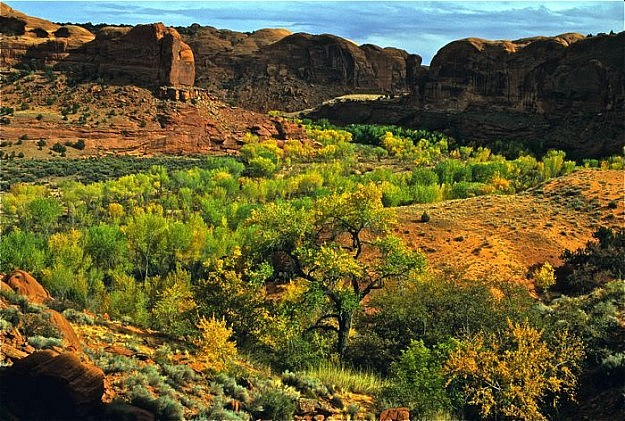
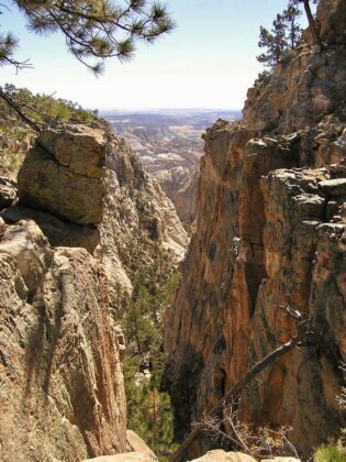
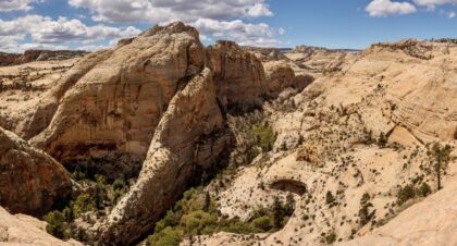 The awesome and beautiful “Slickrock Canyon Country” of southern Utah is wilderness hiking at its best. In the early twentieth century, Mormon settlers transported mail by horse to the isolated town of Boulder, UT. This long-abandoned, historic route, now part of the 1.9 million acre Grand Staircase-Escalante National Monument, crosses three major canyons of the Escalante River including the awe-inspiring Death Hollow. Dropping into Death Hollow’s 800 ft Navajo sandstone chasm is an experience not soon forgotten. This hike showcases some of the most spectacular canyon and slickrock scenery in southern Utah. Marvel at Juniper-pine mesas, cool streams, natural bridges, arches, and peaceful groves of cottonwoods nestled along the Escalante River. The landscape is as spectacular as it is diverse!
Steep drop–offs, mild exposure, and a few steep ascents and descents through the first days of the hike account for the moderately strenuous rating.
We rate this Utah backpacking trip moderately strenuous, and its base is Cedar City, Utah.
TREK BASE: Best Western Plus- 50 West 200 North Cedar City, Utah 84720. 435-586-1234. Please call to book a room and receive the Big Wild Adventures room discount.
MEETING TIME: Pre-trip orientation including food and gear handout plus safety talk at 6 PM the evening prior to the first day of the trip. So if the backpacking trip is from the 3rd to the 8th, the pre-trip meeting is 6 PM on the 2nd.
 TRANSPORTATION: Air service to Cedar City; call motel in advance for ground transport from airport to motel. Alternative: fly to Salt Lake City or Las Vegas and rent a car or ride a bus.
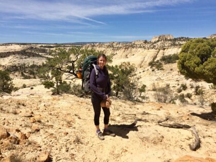
TREK RATING: Daily backpacking mileage on this moderately strenuous trip varies from 4–9. Expect for a few good uphill sections, hiking in sand, lots of stream crossings and some hiking in the river itself. Rock cairns, canyon walls and your experienced guide, will keep us on track. Total backpack mileage is about 30.
ELEVATIONS: 6800 – 5200 feet. One-day elevation gain with backpack can exceed 1000 feet.
WEATHER: Warm sunny days and cool nights are typical; however, cold rain or even wet snow are possible, so prepare for snowstorms to 80 degree heat. Spring weather can change radically. Click here for the National Weather Service forecast.
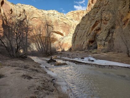
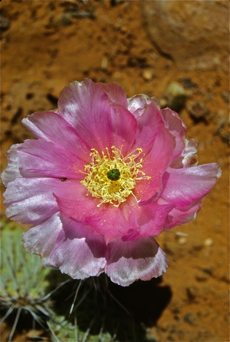
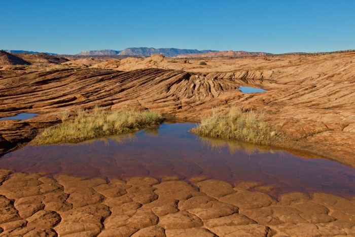
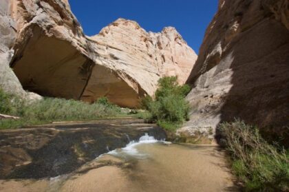
SPECIAL FEATURES: The varied landscape includes pinyon pine/Juniper forests, large expanses of slickrock, sandy benches, towering sandstone walls, unique rock formations such as arches and natural bridges, cool water, pour-offs, and water tanks. Death Hollow’s canyon is spectacular! Hike 14 miles of the Escalante River through picturesque groves of cottonwoods and sheer sandstone walls. We also have a chance of seeing River Otters, reintroduced here in 2005.
SPECIAL TIPS: We will spend a fair bit of time above 6000’ elevation so dress accordingly. There is poison ivy in Death Hollow – bring long-sleeve shirt and pants! We do recommend that you treat your water. Expect sediments/sand in the water. Consider bringing iodine tablets in addition to your preferred filtering method. Your feet will get wet often. Heavy hiking boots are probably not the best option. Light-weight hikers that dry quickly are best. Consider carrying water shoes or sandals for extended soakings and around camp.
STATUS: This trip is within the Grand Staircase-Escalante National Monument (managed by the Bureau of Land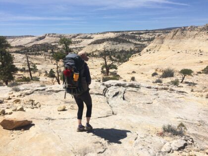 Management). The area has not been designated Wilderness by Congress, so it is not yet fully protected from development.
ITINERARY: The drive from Cedar City to the trailhead takes about 3 or so hours. Our hike first traverses 3 major canyons of the Escalante River; Sand Creek, Death Hollow, and Mamie Creek. A side hike to Mamie natural bridge is planned for this portion of the hike. Our route then follows the Escalante River downstream, crossing and re-crossing the river many times a day. We will enjoy unique geologic features and peaceful cottonwood groves along this stretch of the river.
OTHER UTAH BACKPACKING TRIPS: Click on the following link to read more about our other Utah backpacking trips.
Please Note: Because we vary the route as conditions dictate, mileages and elevations are approximate. Also, the portions of this trip that are within the Glen Canyon National Recreation Area are run by our sister organization, Big Wild Advocates, a 501-c-3 non-profit conservation organization run by Howie and Marilyn. A representative portion of the proceeds will therefore go to the conservation budget of Big Wild Advocates.
Book Your Trip!
Space is limited!
Have questions? Call (406) 823-0337